Trip Report: Cotopaxi Rapid Ascent
Introduction
My wife, brother, and I signed up for a “rapid ascent” expedition to Ecuador for Cotopaxi and Chimborazo. Or rather, I wanted to go, convinced my wife to join me, and then bullied my brother into coming along as well.
The typical trip for this is 15+ days, and looks something like:
- Day 1 - 5: Do a series of acclimating hikes on successively taller peaks you’ve never heard of.
- Day 6 - 15: Actually climb the mountains you flew all this way for.
Recognizing that the limitation for some folks is time away from work/family instead of cost, Alpenglow offers “Rapid Ascent” trips: acclimate at home before leaving and then jump straight to the fun climbing.
This is achieved through sleeping in hypoxic tents that simulate higher altitude by lowering the oxygen % inside the tent itself. Since the Hypoxico rental costs $250/week, minimum rental period of three weeks, this approach doesn’t save any money. It only saves time away from home.
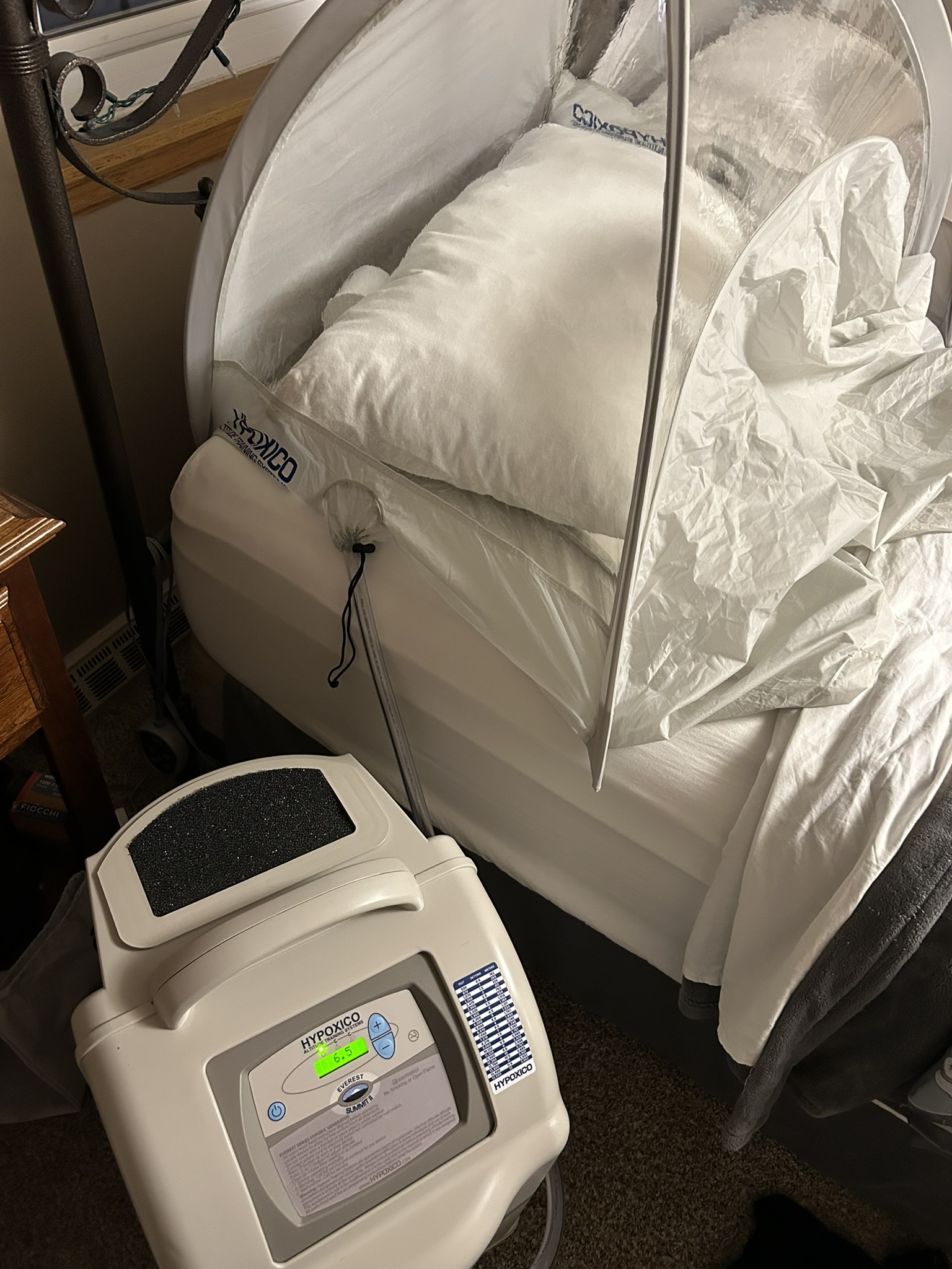
For this specific trip, we would spend four weeks in the tent, and slowly work our way up to a simulated sleeping elevation of 16,000 feet.
A little bit on our climbing background: my wife has done all the 58 Colorado 14ers.
- I have joined her on all but four.
- No, she never lets me forget that I chose to sleep in instead of getting out of the tent and joining her on Windom Peak.
- My brother has joined us for maybe a dozen of them.
Importantly, last summer we did our first expedition to Kilimanjaro and had an absolute blast. It was surprisingly easy, with the guides telling me “pole, pole!” more than once on the way up.
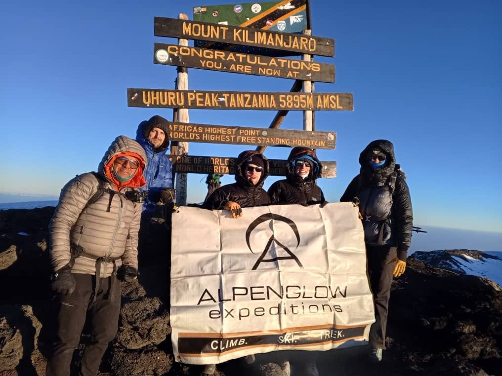
Our lead guide was from Ecuador, and on day 5 or 6 of sleeping like crap in an angled tent with a not-quite-thick-enough sleeping pad on the side of a friggin’ mountain, gave us the best timed sales pitch: For your next trip, go to Ecuador! Climb mountains the same height and taller, but stay in a hotel with a real bed and hot water! None of this camping nonsense.
Unsurprisingly, I was sold. A few months later we had signed up for Cotopaxi (19,341 ft) and Chimborazo (20,530 ft).
Day 0: Packing Up
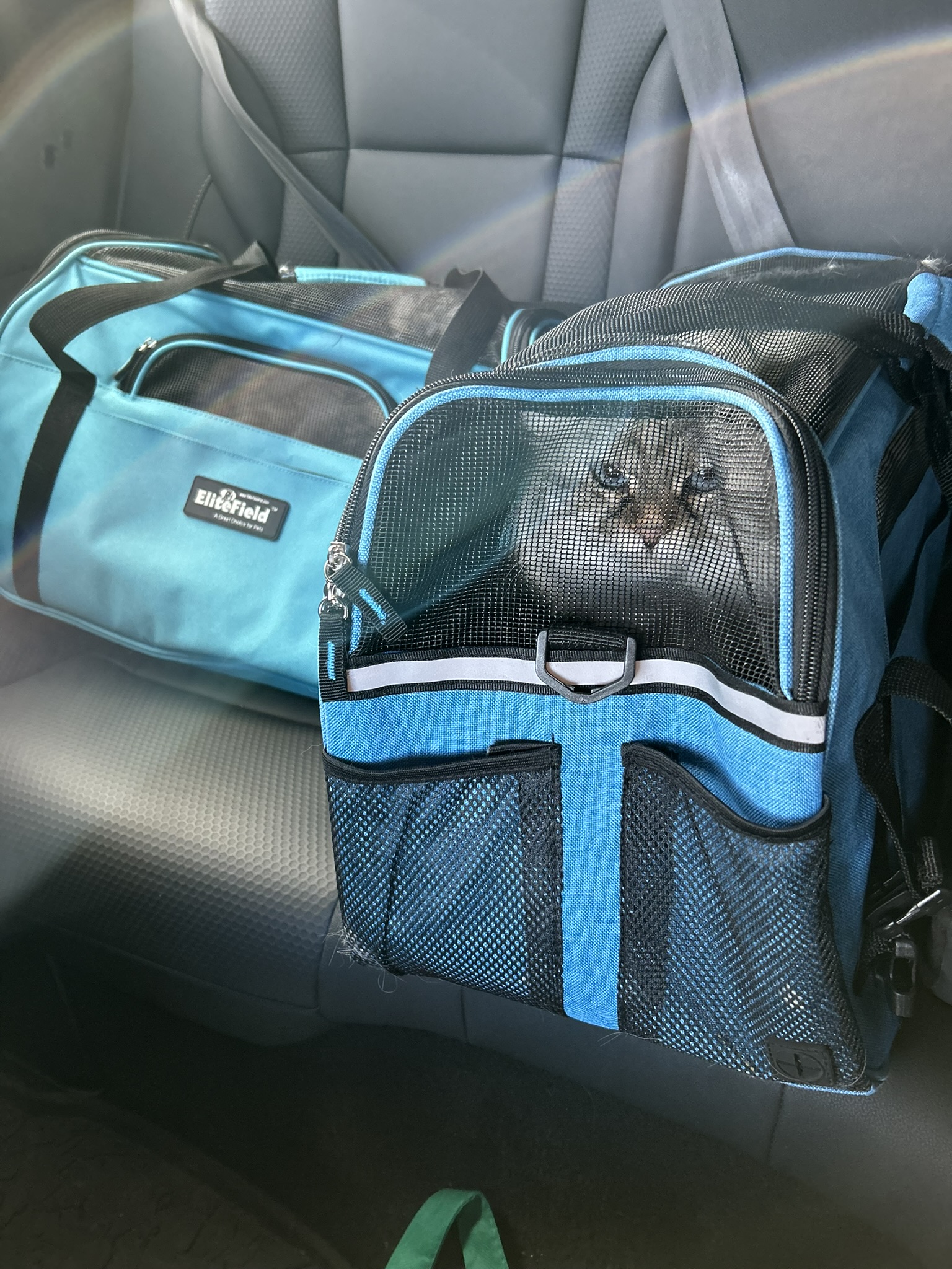
Wow is there so much more stuff to bring on these trips than I at-a-glance think there should be. Do I really need three pairs of gloves, plus liners? When am I ever going to use this belay device? How is all of this shit going to fit in my duffel bag?
Oh and don’t forget we have to take the cats over to my parents house. They’re going to hate us for that… I mean, look at this face:
Day 1: Arrival
We landed in Quito about midnight, and after clearing customs, collecting bags, etc. we got to the hotel around 2am. We were planning to do Pichincha today, but the weather was terrible.
Our guides told us the “standard” weather in Ecuador is clear mornings, with clouds and precipitation rolling in by lunchtime (sounds very similar to Colorado in the summer!) But that was not the case today: rain all day.
A different couple in our group decided to go for Pichincha anyway and had a terrible experience. They got absolutely drenched on the hike itself, and when they got back to the top of the gondola, it was on weather delay and they were stranded for several hours… Dodged that bullet.
Day 2: Acclimating Hike
We left Quito behind and headed to Cotopaxi National Park. We drove up to the refuge at about 15,000 ft and then hiked to the toe of the glacier at about 17,000 ft. The plan was for us to do some glacier skills practice, but there was quite a bit of precipitation so we called this an acclimating hike instead and headed down.
Day 3: Skills Day
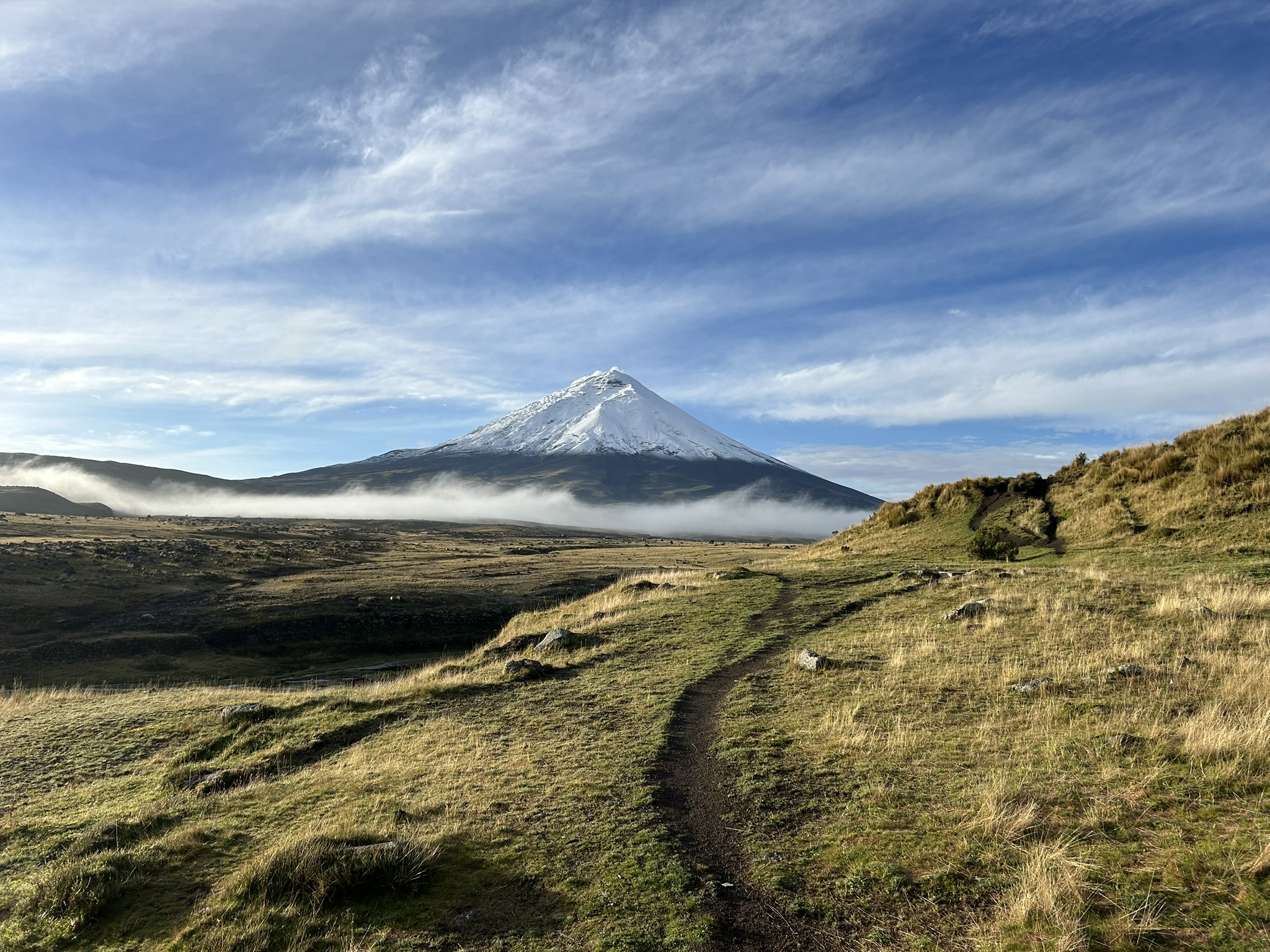
Finally the weather matched the guide’s expectations: a perfectly clear morning. The views from Tambopaxi were jaw dropping.
Just outside the hotel we did the mountaineering day school… on the grass. We didn’t hike back up to the glacier to save energy since our summit push was “tomorrow”.
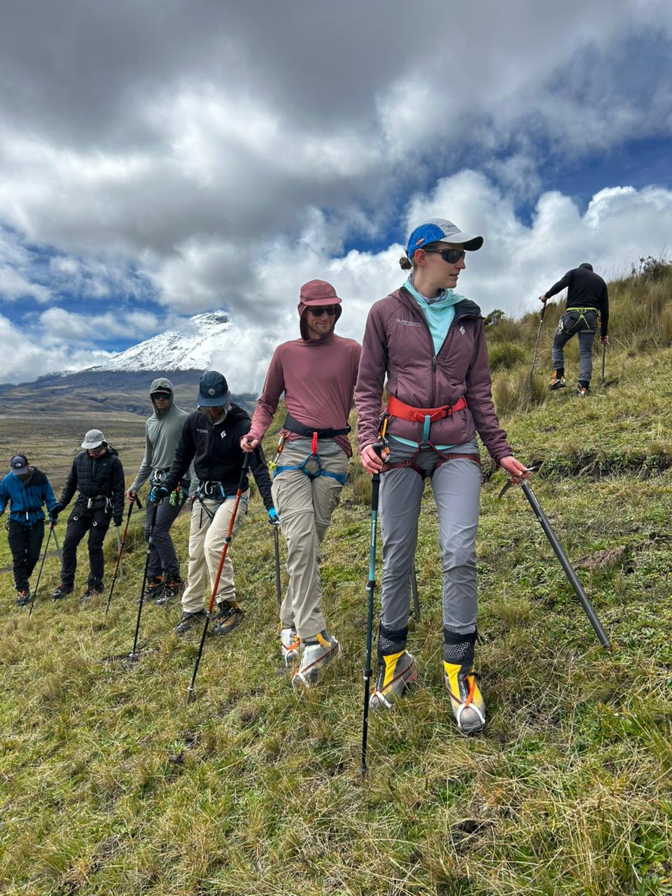
Most of this I had seen before on Rainier, but after lunch we did crevasse self rescue in the hotel, hanging from the rafters! I had never done this before and it was quite a bit of fun. The video below is my wife making it look trivial.
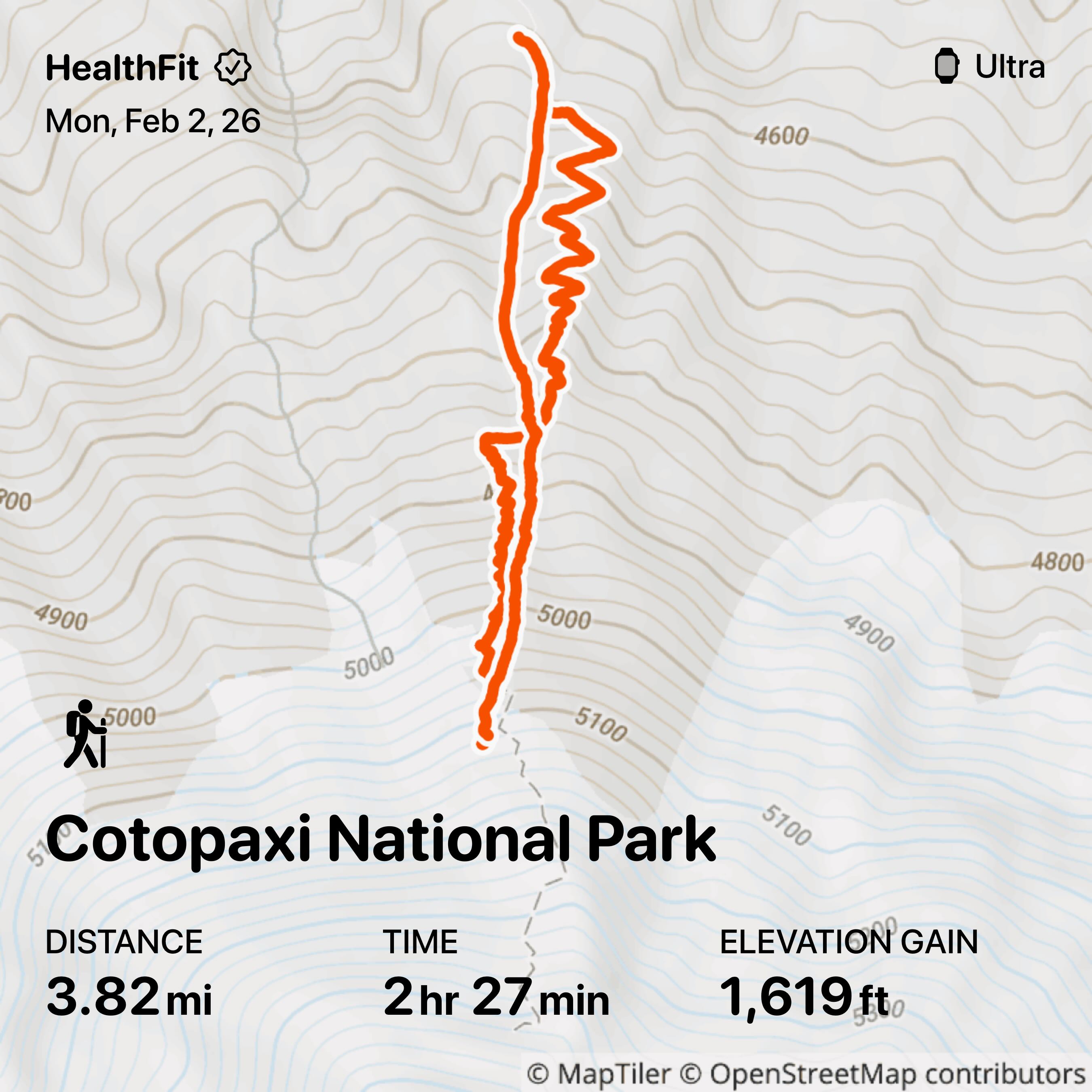
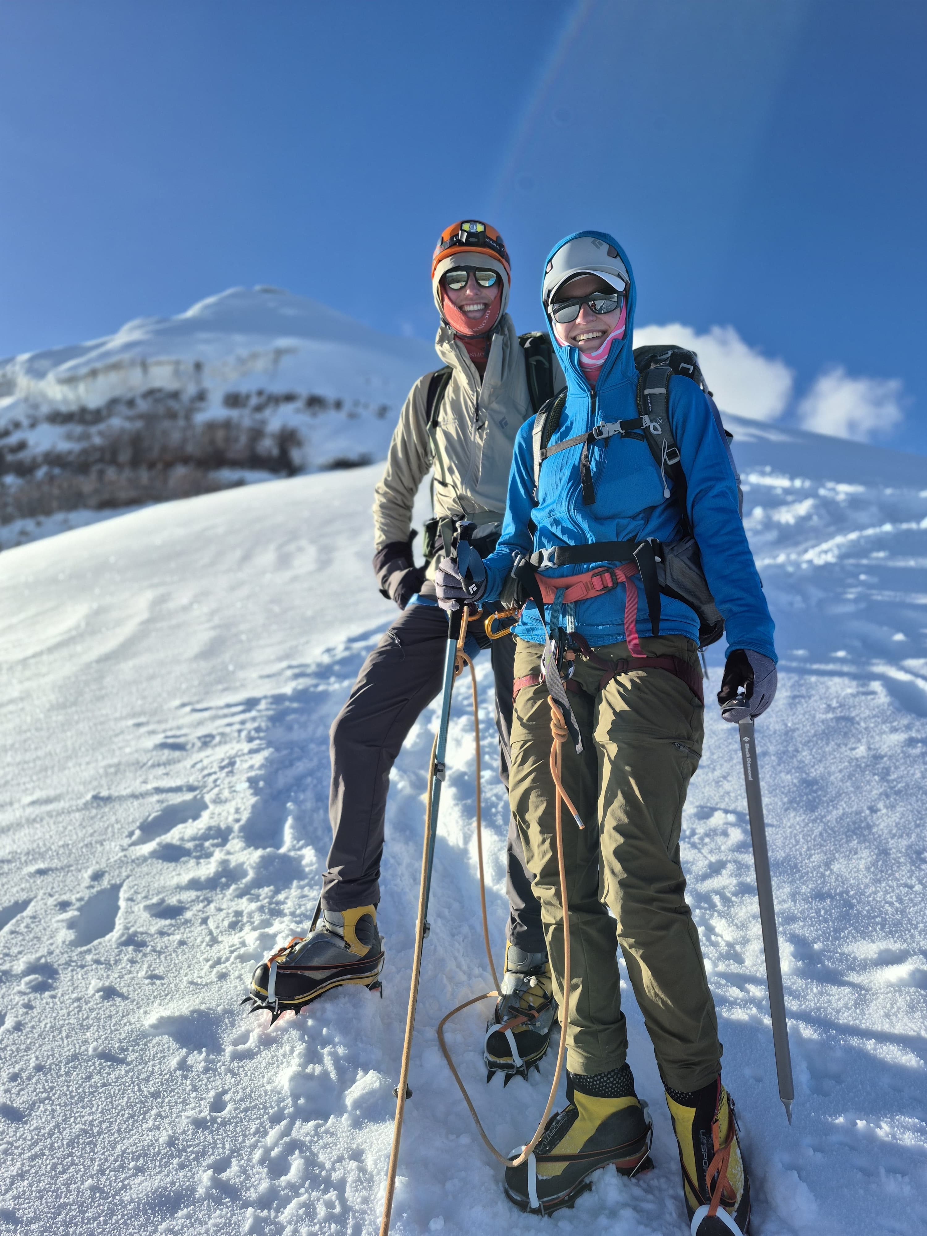
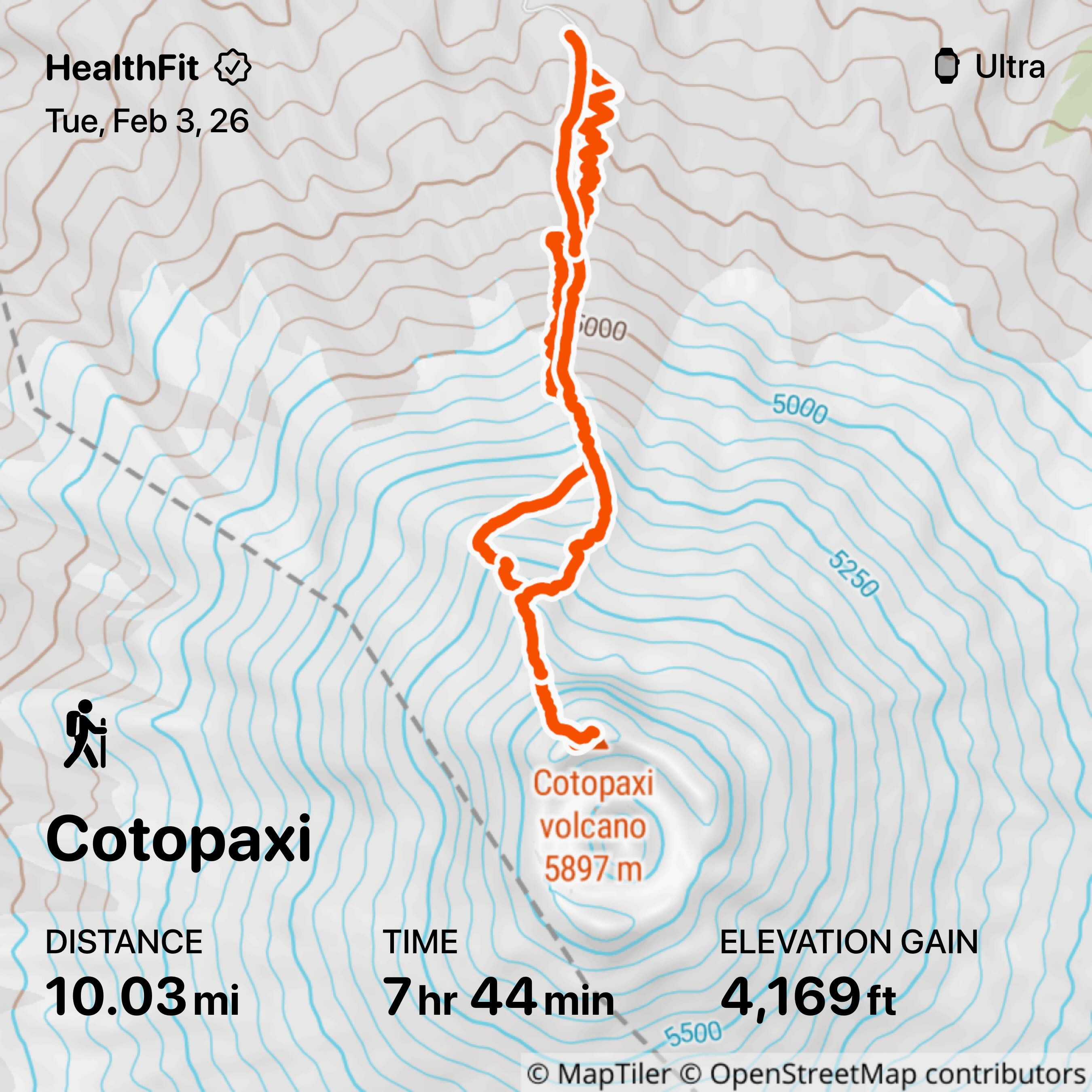
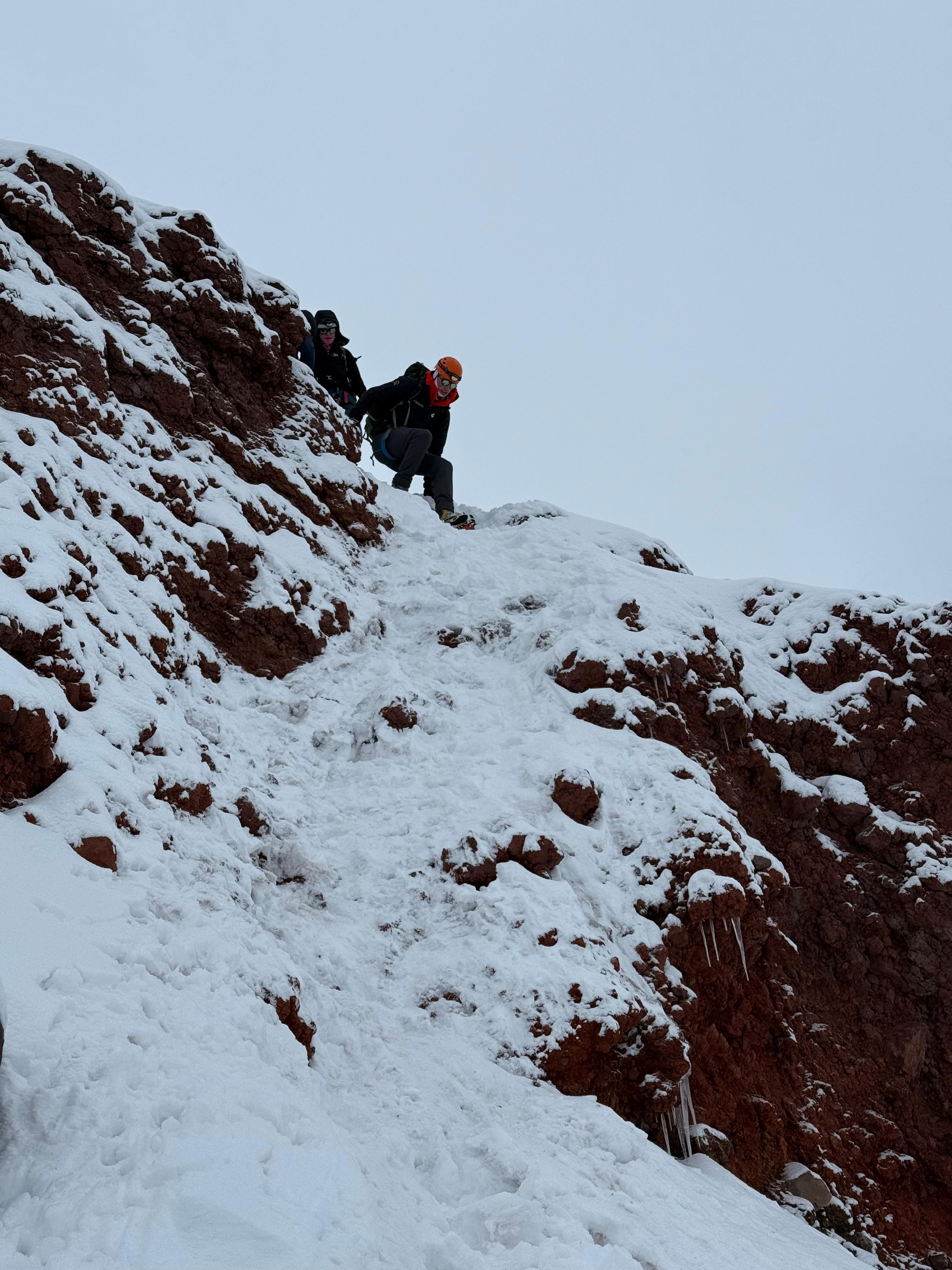
Day 4: Cotopaxi Summit Day
This actually started on day 3. Since we were staying down in Tambopaxi instead of at the refuge—the guides said they hate staying at the refuge: the service sucks, it’s crowded, sleeping sucks at that elevation, etc.—we woke up at 9:30pm.
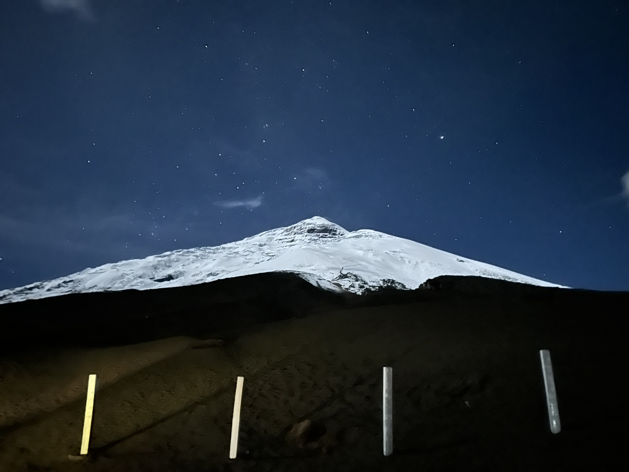
After two cups of coffee and some cookies we headed out and drove to the parking lot at 15k feet. The weather was absolutely perfect. Zero wind, zero precipitation, and almost completely clear skies. We left the car at 11pm with the goal of topping out around sunrise (6:30).
I doubted the “acclimating hike” on day 2 actually did anything… until we hiked the exact same section today, and it was considerably easier. Perceived effort of 2 or 3 (vs 6 or 7 previously) and we actually went at a faster pace.
- Guides: 1
- Me: 0
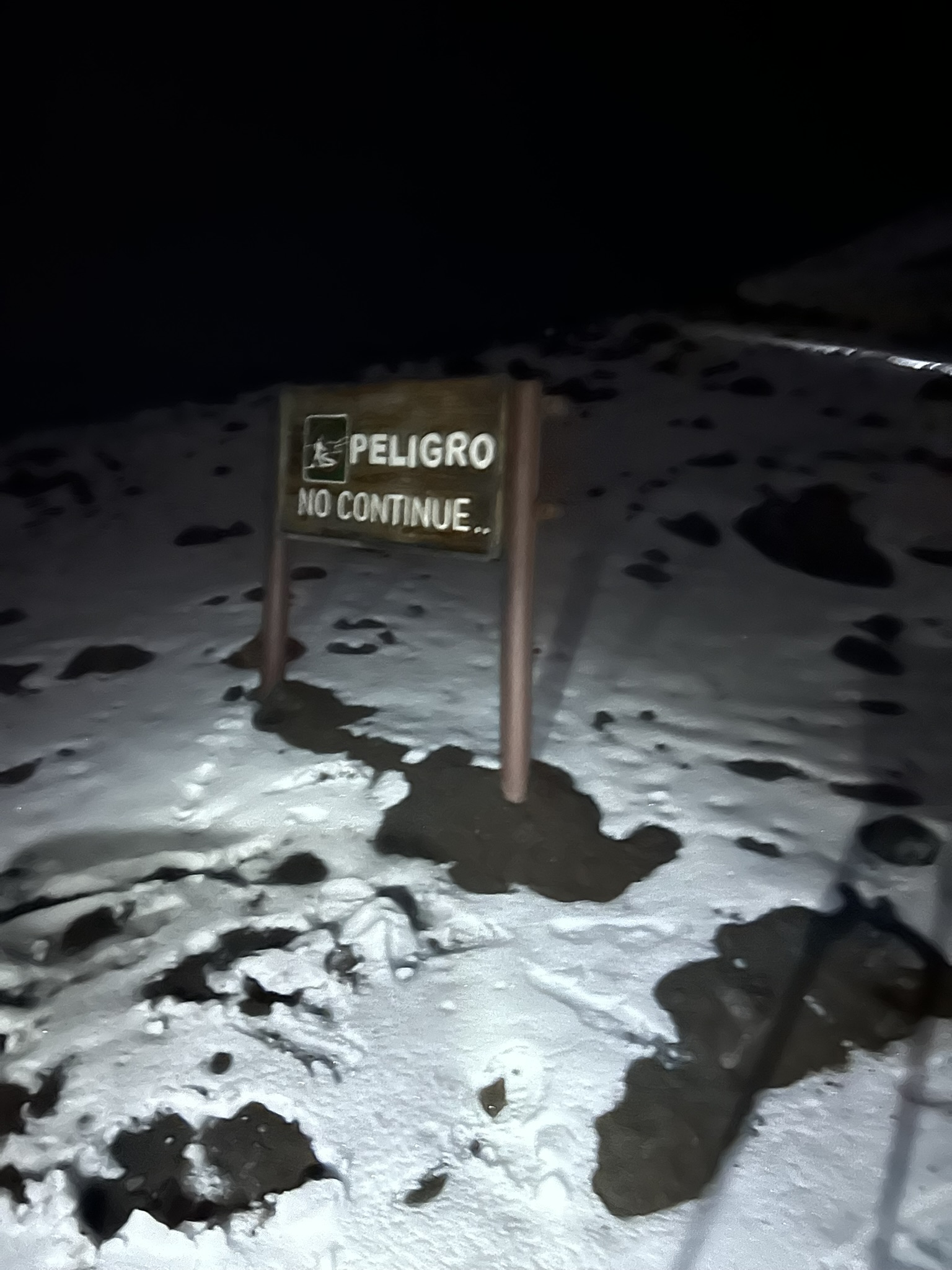
Just above the hut I saw this sign and chuckled as we walked right past it.
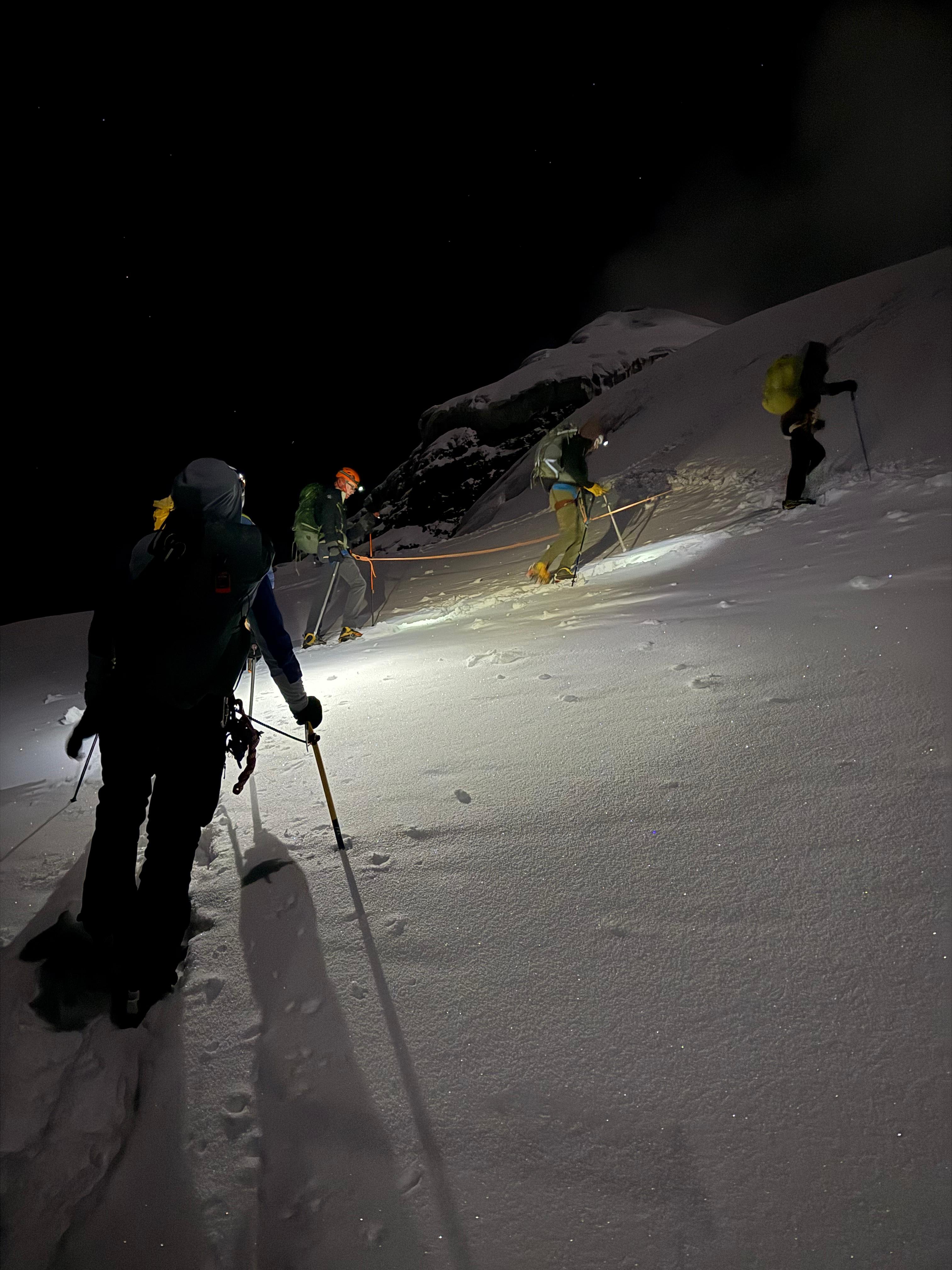
We put crampons on and roped up at 17k feet, which is about where the glacier starts (we were hiking in snow up to this point). The guides started making noises that we were moving faster than expected and we were going to beat sunrise.
As we passed 18,000 ft the altitude started to feel quite a bit more real. While my heart rate was supposedly in Zone 2, it felt much higher/harder than this.
- Nothing to turn around for, but I was disappointed at my performance.
- Kili’s summit day is almost identical in terms of altitude, distance, and vert, yet on that summit day I felt like Superman and was singing almost the entire way to the summit.
- There was no singing today; all I could focus on was step, breathe, step, breathe, step, …
Just below the summit, the guides had us stop and put gas masks on. While we got hints of sulfur in spots, from here to the top it was pretty bad. The masks made breathing a bit harder, but I was starting to feel a bit nauseous which I’m blaming on the H2S (rather than the altitude) as it went away once I masked up.
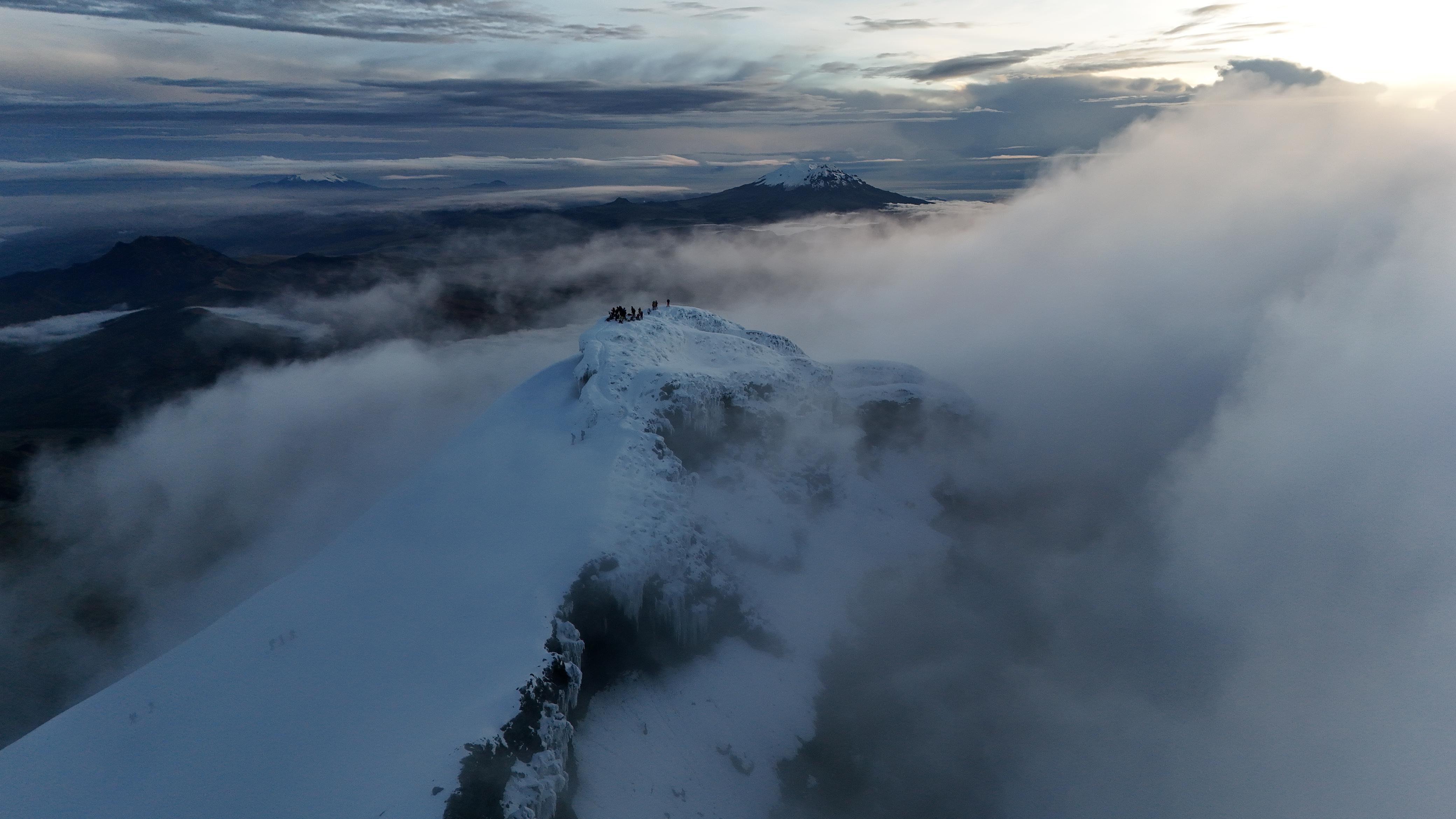
Ten minutes later… summit! Almost exactly at 6am, which meant we got some amazing photos just as the sun was starting to rise. The lead guide had a drone which he pulled out to get this amazing shot.
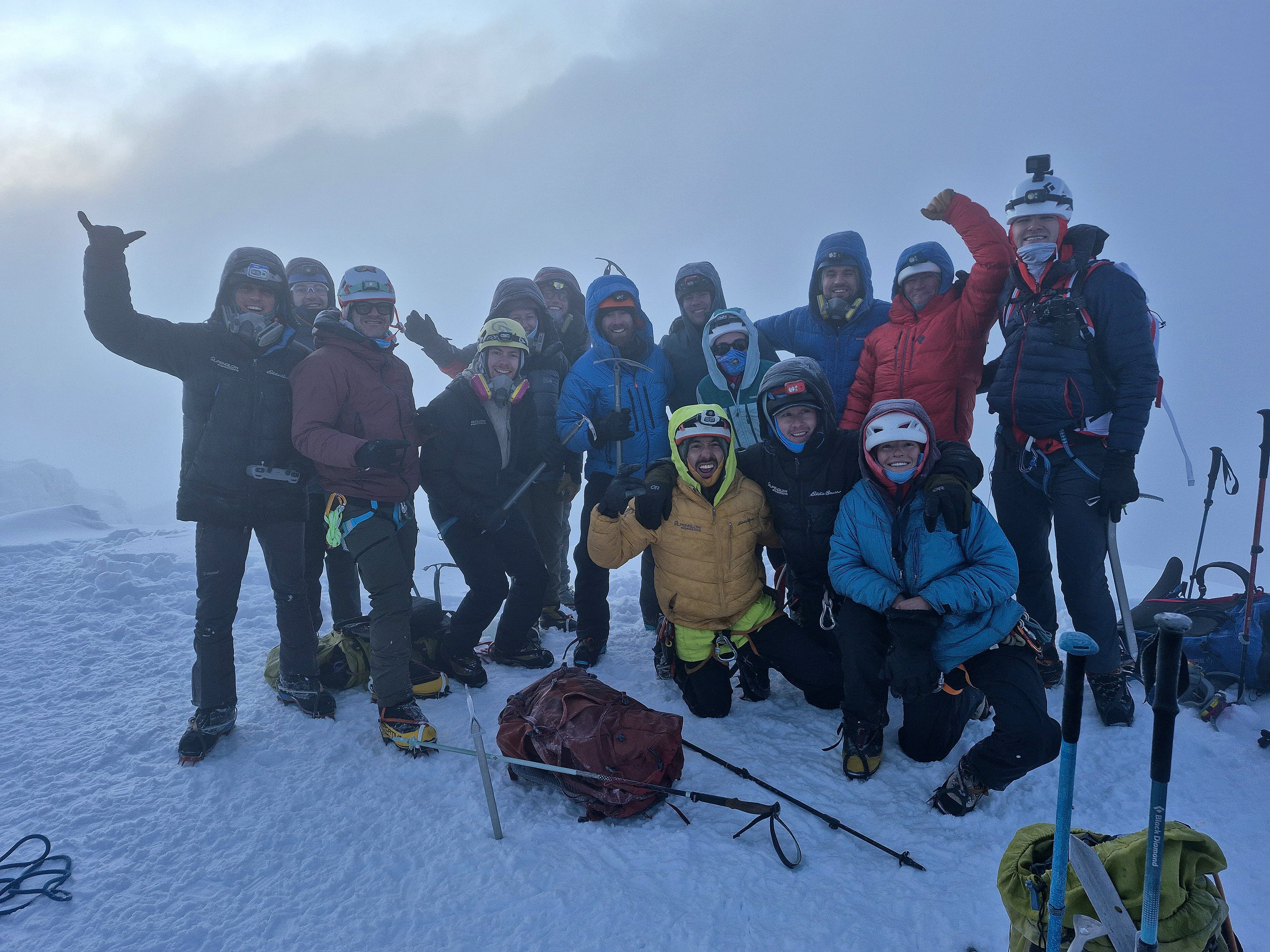
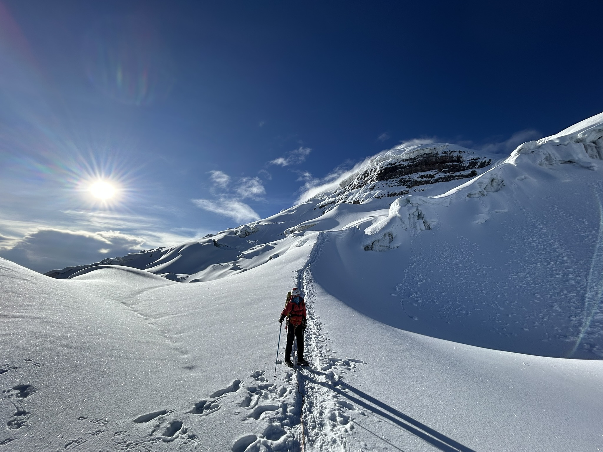
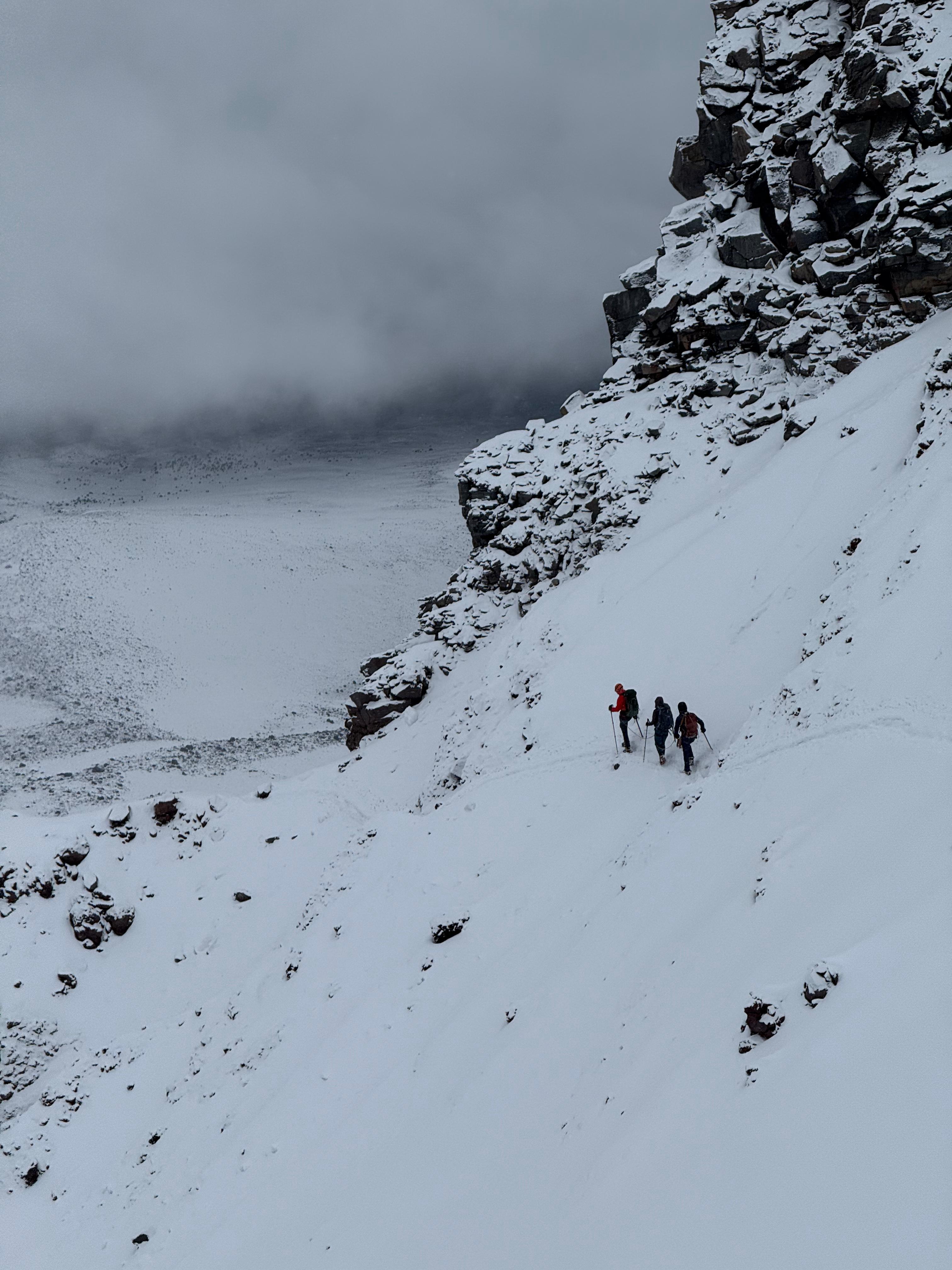
After getting a bunch of photos, we started back down. We took a different route to avoid the long traverse (“the highway”), and it was also quite a bit more scenic. The path meandered around lots of crevasses and gave us some great views of the glacier.
We got back to the car around 9am, and the sun was absolutely roasting us. We stripped down to just a tshirt + sun hoodie and it was still broiling. What a difference from just a few hours earlier where I was a little chilly even in the down parka.
Once everyone else joined us at the bottom, we headed back to Tambopaxi, packed up, and headed to our next hotel.
Day 5: Transit / R&R
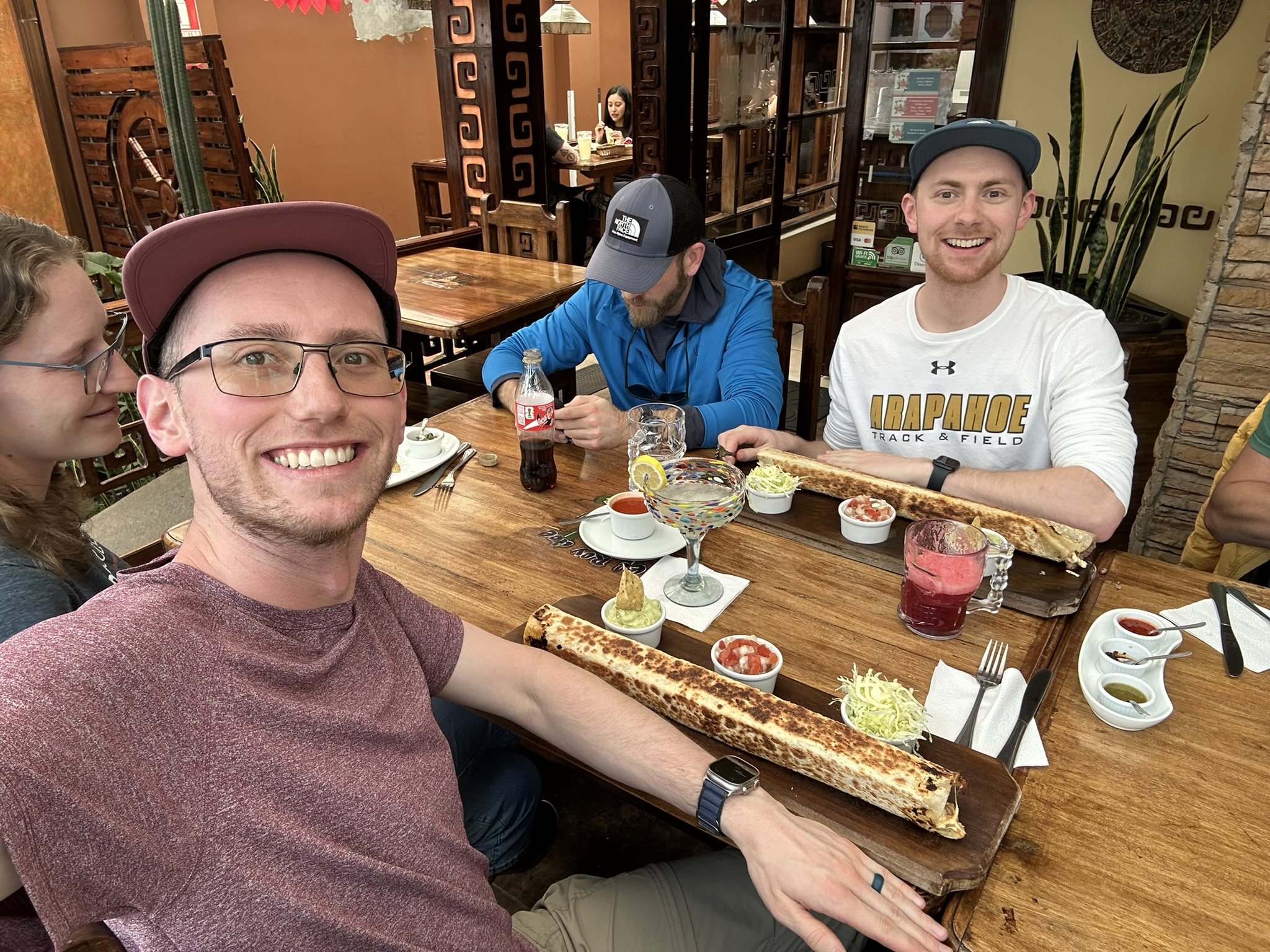
The only plan for today was recovery, and getting in position for our next objective: Chimborazo. A three hour drive took us to our next hotel, with a lunch stop at a Mexican place which had burritos “del Rey” (for the king). These things were huge, but Chimborazo demands calories, so of course I had to get one.
Day 6: To High Camp
Cotopaxi was a pretty big summit day when starting from the parking lot, over 4000 vertical feet. Chimborazo would be even bigger, and at a higher elevation, so we opted for a night at high camp. While sleeping at 17,500 feet wouldn’t be enjoyable, it makes summit day “only” 3,000 feet—though the guides warned us it would take just as long time-wise as Cotopaxi.
The camp itself was quite nice, I was expecting a not-so-flat tent that we’d have to crawl into. But apparently the camp just got a more permanent operating permit, and they upgraded the accommodations to big domes with bunk beds. Dinner was also solid: freshly cooked chicken soup, with a pork chop as the main course.
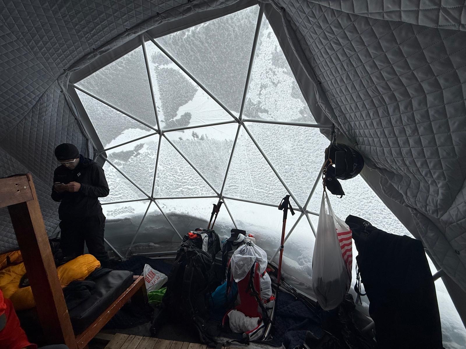
The main surprise was how exposed the camp was: just a few feet away from the entrances to the tents was a surprisingly large drop off. Solid footing was a must when walking to/from the bathroom…
After dinner we started hearing some bad news: only one team (out of 10+) had managed to summit this morning because of dangerous snow conditions. The lead guide of that group said it was only barely within his risk tolerance of continuing…
The danger on Chimborazo that is not really present on Cotopaxi is avalanches. For those with zero knowledge on the subject, here’s a primer from someone with only a tiny bit of knowledge on it:
Avalanches require three things: slope, snow, and a trigger.
- Avalanche terrain is primarily a slope angle of 30-45°, below that is too flat to slide, above that slabs don’t form. The most dangerous slope angle is 37°.
- Once you gain the ridge above high camp, the slope is 30-37º all the way to the lower summit.
-
The main avalanche problem that maritime snowpacks, e.g. Ecuador, have is storm slab. This occurs when a lot of fresh snow falls. (Colorado doesn’t have this problem :lol-sob:)
- Climbing on/connected to avalanche terrain makes you the trigger.
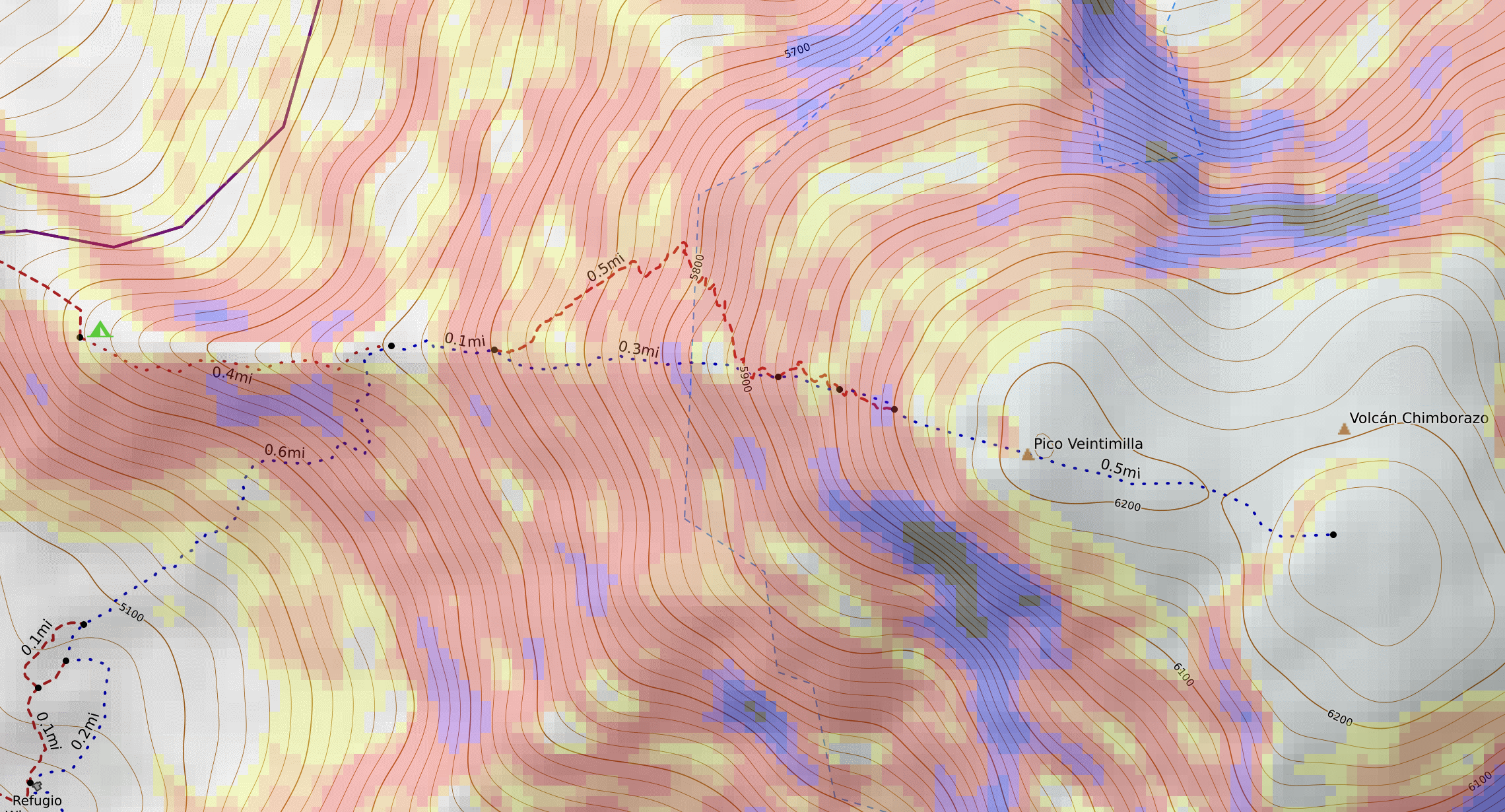
Everything shaded in red is 35º, i.e., avalanche terrain. Notice how much of the route is on that...
Putting all that together, lots of fresh snow is bad for a summit bid. And guess what had been falling from the sky all day, and was forecasted to continue well into the night…?
Snow, snow, and more snow. If only we could swap winters: give Colorado “too much” snow and give Chimborazo the nice clear skies…
This concern isn’t just theoretical: in 2021, six climbers died (with seven more buried but rescued) after a massive storm slab avalanche was triggered by the climbers on this exact route up Chimborazo.
With that somber note, we tried to sleep. The plan set to wake up at 11pm and make a call on weather and hopefully be leaving by midnight.
Day 7: Chimborazo Summit Day
Not a lot of sleep happened. I didn’t take any sleep aide as I’ve heard from multiple guides they are respiratory depressants and can hurt acclimation. Given I had never slept at this altitude before plus the pounding headache I had coming down from Cotopaxi, I didn’t want to risk it.
I knew the news wasn’t going to be good when it was 11:30pm and we still hadn’t heard anything from the guides. Sure enough, they came into our dome a little later and informed us the weather was terrible. Quite a bit of fresh snow with extremely low visibility and even more falling. They wanted us to go back to sleep, and they were going to wake us up if it cleared. 2am was the go/no-go point: we had to be leaving by then to have a hope at making the summit.
At 1:30 they came back and told us the summit wasn’t going to happen. Two groups had left at midnight to try and push even with the shitty conditions… but had already turned around and were heading back to camp due to the weather.
A bummer for sure. If only the guides could control the weather! But as one of our teammates put it succinctly: “I don’t feel the need to die tonight”.
I’m not sure if it was the stress of whether we were going to summit being gone, or exhaustion finally winning, but after that news I slept wonderfully for the next couple hours.
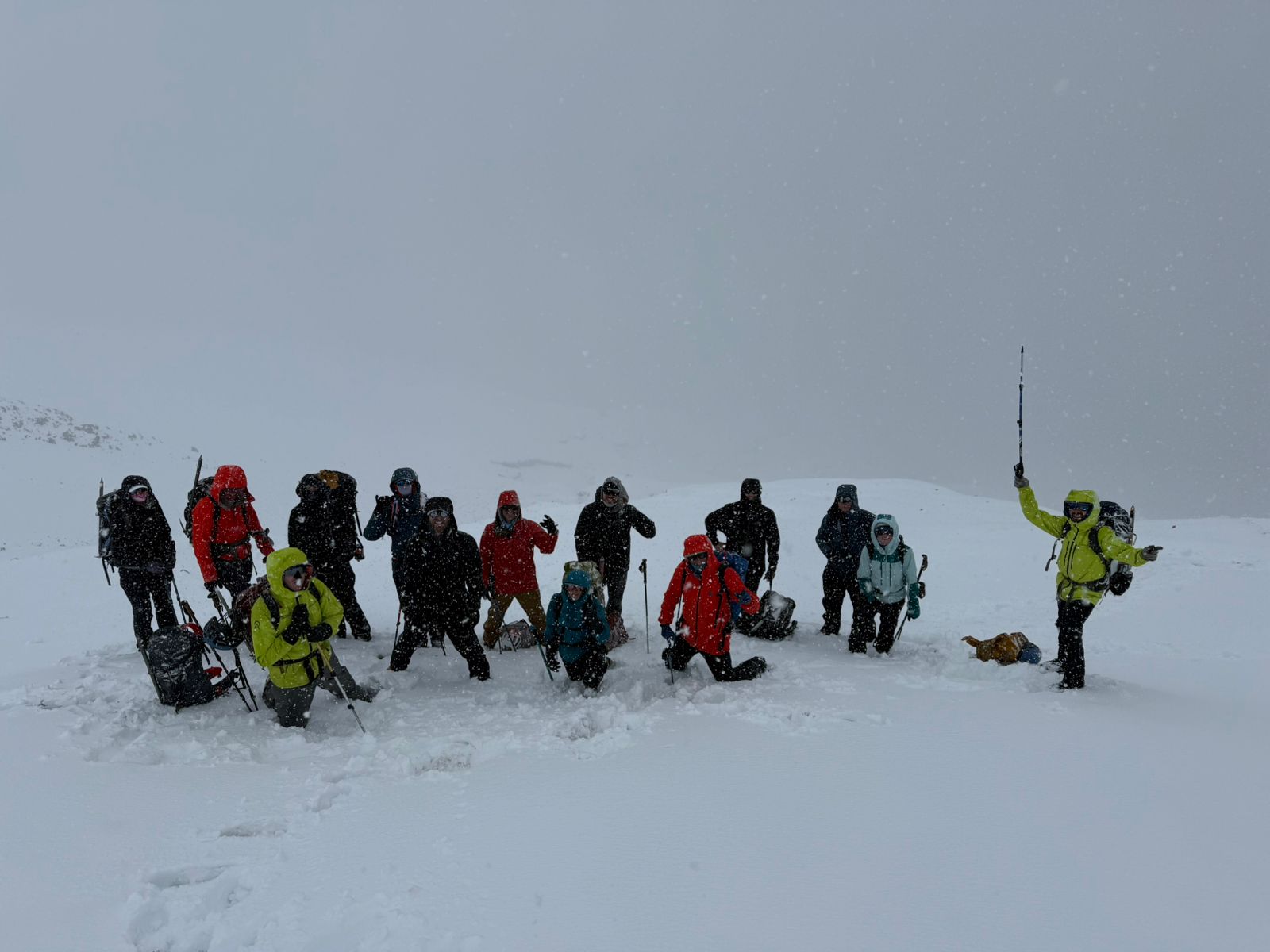
At 4am, the guides came back in and said the weather had cleared up, so if anyone was interested, they were offering to take us on “a walk” up to the ridge above camp. It turned out all of us wanted to go for the “walk”, or at least felt FOMO after the first person said yes.
The “walk” was actually quite fun: a bit of a traverse, then a “rock step”, followed by some fairly steep snow up the ridge. We went about halfway up, 1500 vertical feet, though the guides assured us it was only ⅓ the total time, as the remaining climb to the top was quite challenging and would have taken “at least four more hours”.
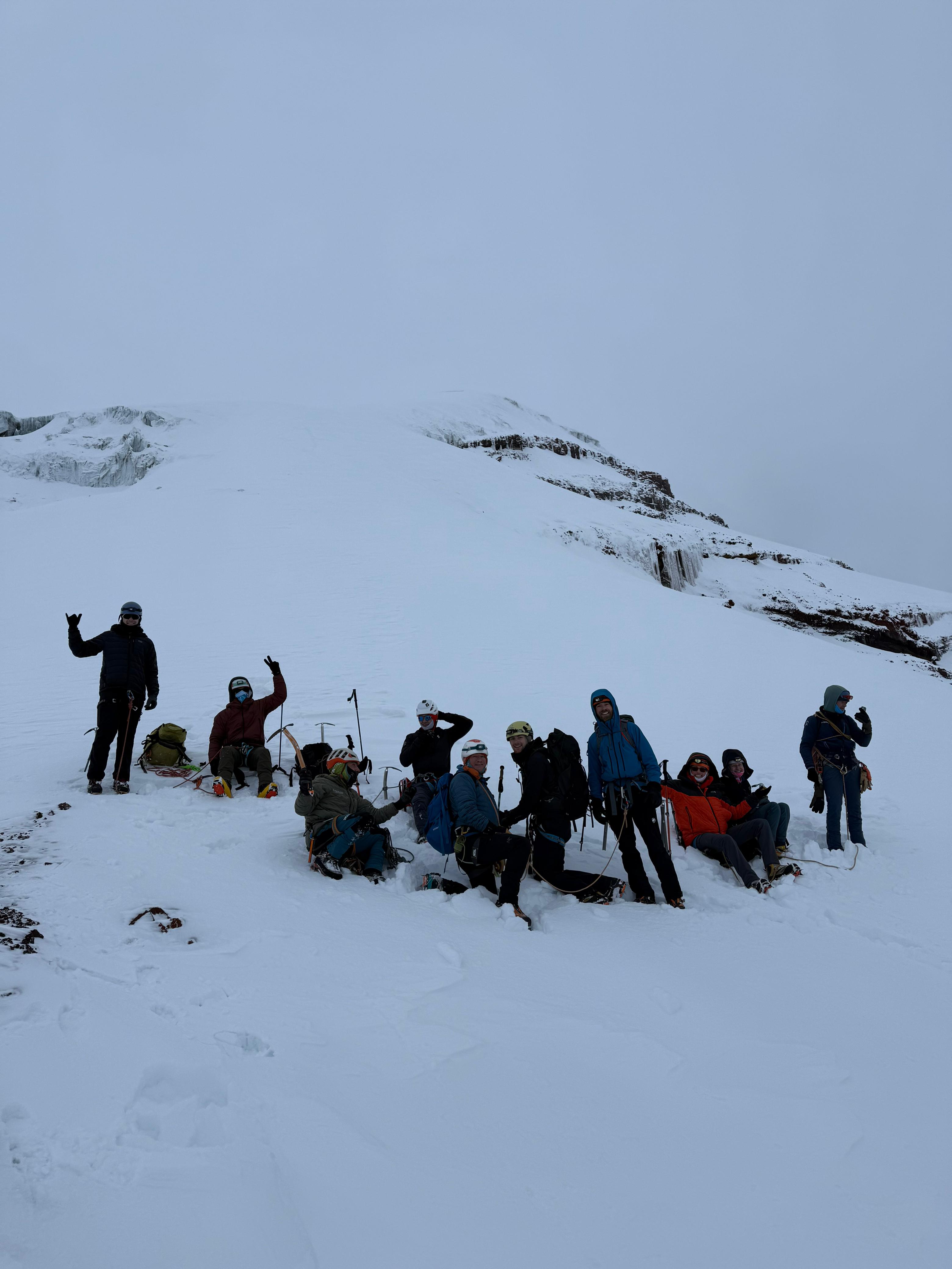
While of course I wish we could have made the summit, today was one to follow Rick Steves’ advice: if you aren’t able to do an activity on your trip, simply add it to the list of reasons to return.
My list of reasons to return to Ecuador:
- Cayambe
- Antisana
- (and now) Chimborazo
Analysis
This is the part of trip reports I wish more people wrote. What was surprising? What would you do the same vs differently?
Rapid Ascent
Let’s start with the big choice: to rapid-ascent or not?
Pros:
- It works.
- We climbed an almost 6000m peak within three days of landing in-country.
- …with a 100% summit success rate.
Cons:
- Sleeping in the tent sucks.
- It’s hot, uncomfortable, and negatively impacts recovery from training.
- Hypoxico also doesn’t want you traveling with the unit (risk of damage), and even if you do, it’s big/bulky and heavy.
- The unit itself weighs ~58 lbs, and the box it comes in is 72 linear inches.
- If you wanted to fly with this, you’ll be charged for both overweight and oversized bag fees.
- Therefore you need to carve out a big chunk of time to do zero overnight trips.
There was a MD on the trip who bought a C02 monitor, and claimed the levels inside the tent are >5x what’s considered the “safe limit”. She was adamant if we were going to use the tent again we should find an alternative to their head bivy since it doesn’t have proper ventilation.
I’m not sure the benefits outweigh the costs for this short of a trip.
- A month of pain to save only one week doesn’t quite seem worth it in hindsight.
- For the longer trips to Asia, where the tent starts saving three or four weeks away from home…? That’s a different story, and I want to try that out one of these days.
All that being said, I still love the idea of a quick-trip to snipe a mountain, just not with one of these tents.
- These were designed for people coming from sea level, with no real way to get “real” altitude.
Living in Colorado is an advantage I think can be exploited here.
- I live at 6,000 feet and can easily sleep at 10k feet right off the couch with zero sleep disruption or other AMS symptoms.
- Furthermore, the high country (up to 14,000 ft) is quite accessible here, especially in the summer.
- Pikes Peak has a visitor center with heating, power, and wifi at the summit.
Putting this together, I think a 4-5 day trip to get one of Ecuador’s other 6,000m mountains is quite doable without the tent, with some focused altitude time shortly before going.
Weather
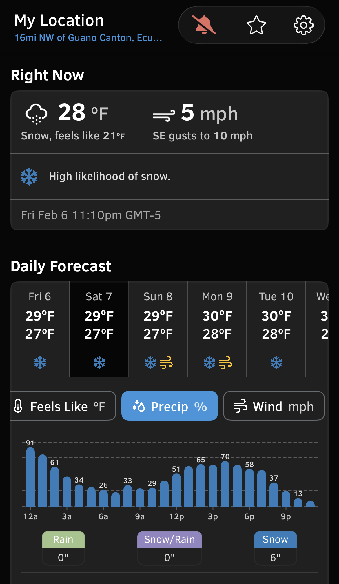
Now let’s talk about weather and weather forecasts. Something we heard constantly from the guides was to not trust the forecast, as they’re “not accurate in Ecuador”. I realize this is just an anecdote, but OpenSnow absolutely nailed the forecast while we were there.
It called for:
- A lot of rain in Quito that first day
- Beautiful climbing conditions on Cotopaxi
- and lots of snow on Chimborazo
…and that’s exactly what happened.
Cost
This is what we paid per-person cost for the trip:
| Item | Cost |
|---|---|
| Alpenglow expedition fee | $6,100 |
| Round trip flights from Denver | $600 |
| Total tips for the guides | $500 |
| New gear specific to this trip (crampons, etc) | $200 |
| Cost of in-town food | $100 |
| = | $7500/person |